
The world of robotics has witnessed significant advancements in recent years, with the integration of Light Detection and Ranging (LIDAR) technology being a pivotal factor. LIDAR, a remote sensing method that uses laser light to measure distances, has revolutionized the way robots perceive and navigate their surroundings. This article delves into the realm of robot LIDAR usage, exploring its applications, benefits, and future prospects.
What is LIDAR Technology?
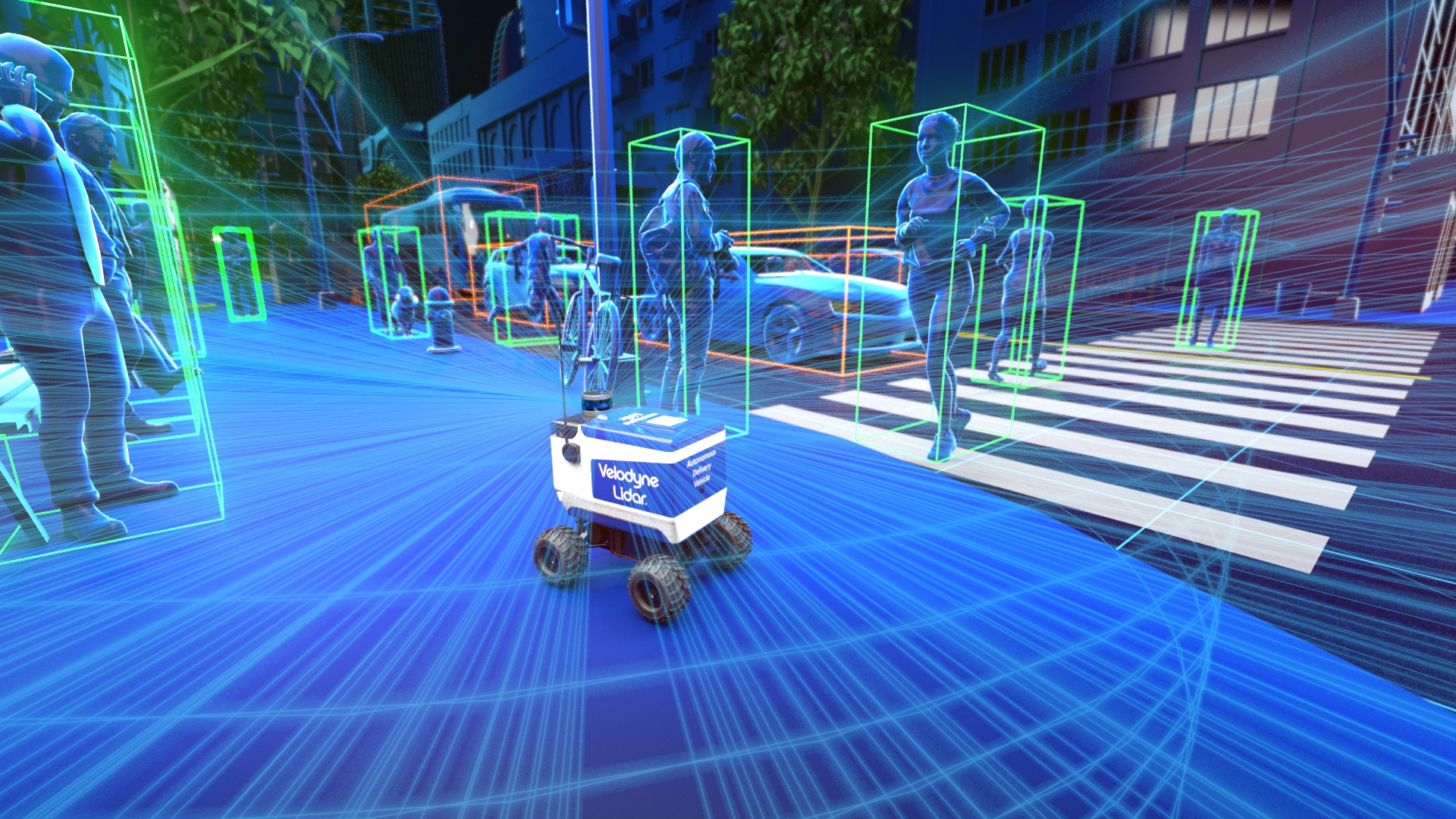
LIDAR technology employs laser light to create high-resolution, 3D maps of environments. By emitting laser pulses and measuring the time-of-flight and wavelength of the returning signals, LIDAR systems can accurately determine the distance, velocity, and other properties of objects within a scene. This information is then used to create detailed point cloud data, which can be analyzed to extract valuable insights.
Robot LIDAR Usage: Applications and Benefits
Robot LIDAR usage has numerous applications across various industries, including:
- Autonomous Vehicles: LIDAR is a crucial component in self-driving cars, enabling them to detect and respond to their surroundings. By creating detailed 3D maps of the environment, LIDAR helps autonomous vehicles to navigate through complex scenarios, such as intersections, pedestrian crossings, and construction zones.
- Industrial Robotics: LIDAR is used in industrial settings to enhance robot navigation, localization, and obstacle detection. By providing accurate and reliable data, LIDAR enables robots to operate efficiently and safely in dynamic environments.
- Surveying and Mapping: LIDAR is widely used in surveying and mapping applications, such as topographic mapping, urban planning, and disaster response. By creating detailed 3D models of environments, LIDAR helps professionals to make informed decisions and respond to emergencies effectively.
- Agriculture and Forestry: LIDAR is used in precision agriculture and forestry to monitor crop health, detect pests and diseases, and optimize harvest planning. By providing detailed information about vegetation density and height, LIDAR enables farmers and foresters to make data-driven decisions.
The benefits of robot LIDAR usage are numerous:
- Improved Accuracy: LIDAR provides highly accurate data, enabling robots to navigate and interact with their surroundings with precision.
- Enhanced Safety: By detecting obstacles and hazards, LIDAR helps robots to avoid collisions and ensure safe operation.
- Increased Efficiency: LIDAR enables robots to operate autonomously, reducing the need for human intervention and increasing productivity.
- Cost-Effectiveness: LIDAR can reduce costs associated with manual data collection, surveying, and mapping.
Challenges and Limitations
While robot LIDAR usage has numerous benefits, there are also challenges and limitations to consider:
- Interference and Noise: LIDAR signals can be affected by interference and noise, reducing the accuracy of the data.
- Weather Conditions: Inclement weather, such as fog, rain, or snow, can impact LIDAR performance and accuracy.
- Cost and Complexity: High-resolution LIDAR systems can be expensive and complex to integrate and maintain.
- Data Processing and Analysis: LIDAR data can be vast and complex, requiring significant processing power and expertise to analyze and interpret.
Future Prospects and Advancements
The future of robot LIDAR usage is promising, with ongoing research and development aimed at addressing current challenges and limitations. Some potential advancements include:
- Solid-State LIDAR: Solid-state LIDAR technology promises to be more compact, efficient, and cost-effective than traditional LIDAR systems.
- Multi-Beam LIDAR: Multi-beam LIDAR systems can provide higher resolution and faster data acquisition rates, enabling more accurate and detailed mapping.
- Artificial Intelligence and Machine Learning: The integration of artificial intelligence and machine learning algorithms can enhance LIDAR data analysis and interpretation, enabling more accurate and informed decision-making.
FAQ
- What is the difference between LIDAR and other sensing technologies, such as radar and camera systems?
LIDAR uses laser light to measure distances, while radar uses radio waves, and camera systems use visible light. LIDAR provides higher resolution and accuracy than radar and camera systems. - How does LIDAR work in low-light conditions?
LIDAR systems can operate in low-light conditions, as they use laser light to illuminate the environment. However, performance may be affected by extreme darkness or interference. - Can LIDAR be used in outdoor environments, such as forests or construction sites?
Yes, LIDAR can be used in outdoor environments, but performance may be affected by weather conditions, vegetation, or other obstacles. - What is the typical range and resolution of LIDAR systems?
The typical range of LIDAR systems can vary from a few meters to several kilometers, while resolution can range from a few centimeters to several meters. - How much does a LIDAR system cost?
The cost of a LIDAR system can vary widely, depending on the resolution, range, and complexity of the system. Prices can range from a few thousand dollars to hundreds of thousands of dollars.
Conclusion
Robot LIDAR usage has revolutionized the way robots perceive and navigate their surroundings, enabling accurate and efficient operation in various industries. While there are challenges and limitations to consider, ongoing research and development are aimed at addressing these issues and enhancing the performance and accessibility of LIDAR technology. As the technology continues to evolve, we can expect to see increased adoption and innovative applications of robot LIDAR usage, transforming the way we interact with and understand our environment.
Closure
Thus, we hope this article has provided valuable insights into Introduction to Robot LIDAR Usage. We thank you for taking the time to read this article. See you in our next article!
